Light Snow Likely Friday
Page created on: 2025-01-07 03:46:38
Vigorous wave will move south of the region Friday creating the next winter storm to impact the central US.
When analyzing for local snow impacts, I used Memphis as a rule of thumb. If the core energy of the storm moves close to Memphis it is far enough south to have enough cold air to maintain snow locally and it was far enough north to transport GOM moisture and produce heavier events. The event projected for this Friday shows core energy along the GOM coast. IMO, too far south to produce a large snow event but an event that has ample moisture to produce locally if there is available lift and shear. The lift and shear is projected in the form of a weak wave syncing with the main wave to the south. Tilting forward suggests weak low pressure but strong push of cold air. This is a snow event locally, not a mix.
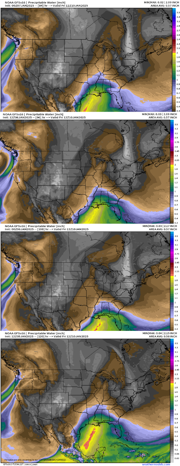
I present a trend sequence of the moisture plume. I read a couple of things. Inconsistency in detail with strong consistency in general. Lower Ohio River Valley (LORV) is the northern edge of the moisture plume in the flow of the storm moving north. This appears in each panel but the exact placement of the edge moves subtly. Available moisture equates to snow amount and when evaluating an edge it can mean a significant difference in verification vs forecast.
The fact that we are expecting a push of cold air through the week should keep this storm south so I have little confidence in a heavy snow solution locally. Analyzing several solutions leads to a 1" general solution with 2" inside the reasonable. I have seen bigger numbers but none top 5" at this point.
Friday snow showers with 1-2" accumulation, possibly an isolated higher total seems solid analysis at this point for southern Illinois. More chance of 2" but less chance of more than 4" around OWB.