Friday Snow
Page created on: 2025-01-09 04:40:23
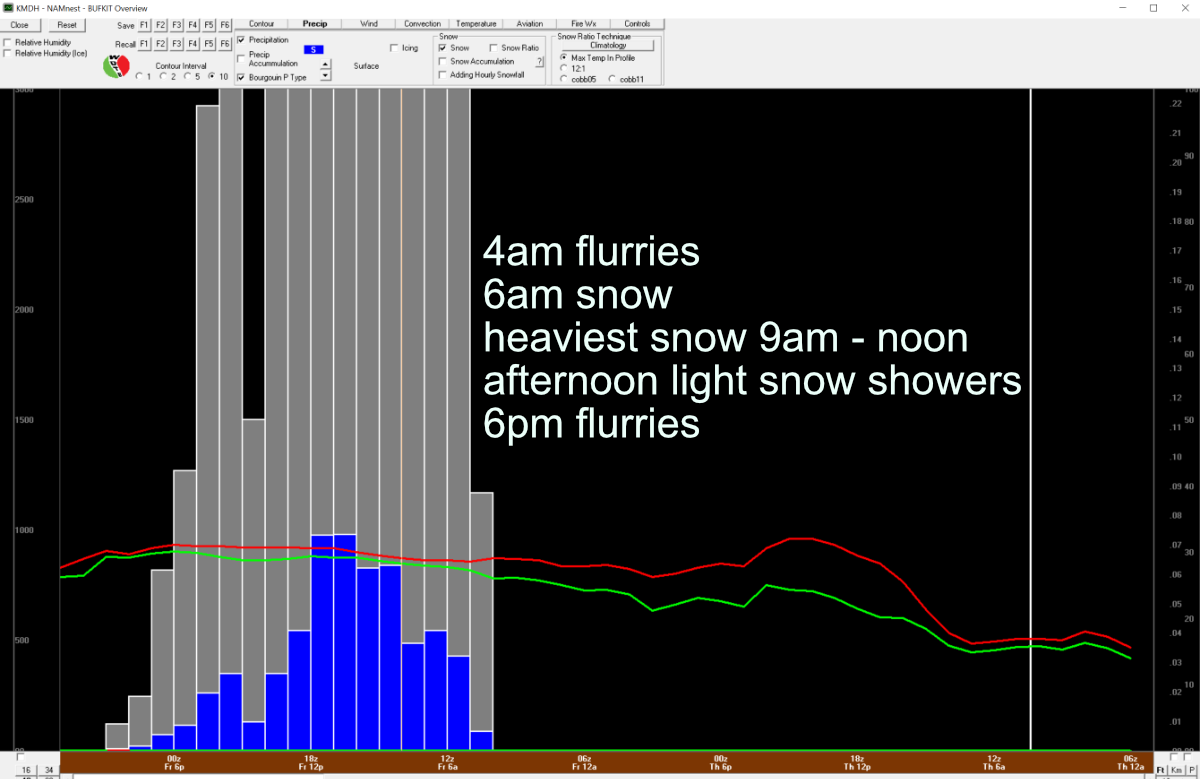
Minor adjustments in charts this morning but the consistent solution of accumulating snow is in place.
I stated a few days ago (without data to support) it is hard to think of 12 hours of snow and only 2" accumulation. There is still one set of data that consensus presents 2" even it has increased range numbers presenting more 3s and 4s. My answer yesterday when asked was 3" is a good number. 2 days ago I said 2 to 4 lean to the 2. This mornings run presents bigger numbers. Not a lot bigger but consistently bigger.
Chart this morning has very similar timing and type to the solutions we have been looking at for days. Early morning flurries, sunrise snow, snow all day, snow ends sunset and flurries all evening. Saturated stack of atmosphere makes this an efficient snow maker. Should be some visually appealing snowflakes. Dry snow with cold crystals. 3-5" is the range presented across the 2 models sampled. If I was contesting I would post 3.5".
Summary: 3 or 4 inches of snowfall Friday, isolated spot might see a little more, lowest totals will be 2"+. Snow all day Friday with little wind controlling blow/drift concerns.