Friday Snow Is Here
Page created on: 2025-01-10 04:50:17
I observed the first flake at my place around 4:30am.
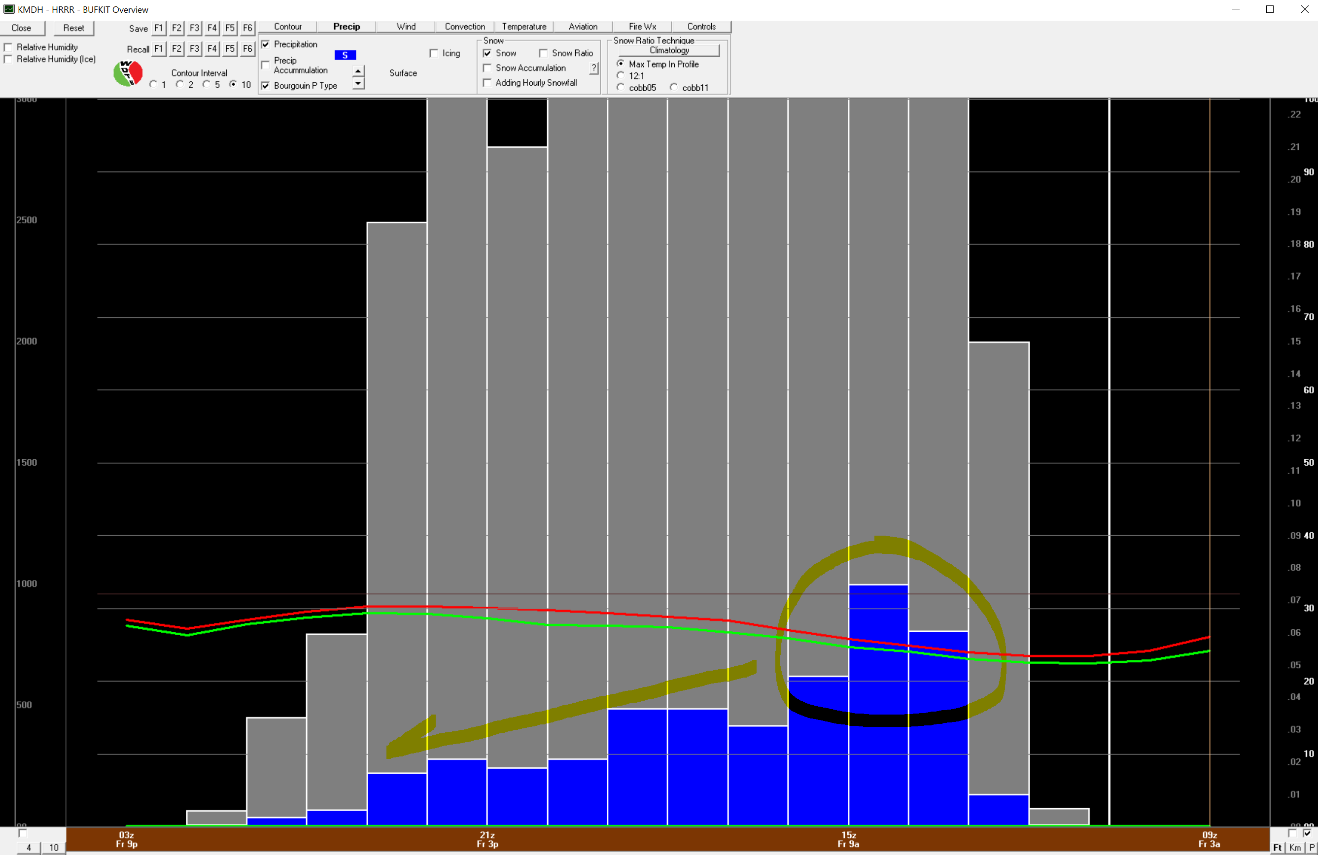
This event has moved inside high resolution data and changing what we look at makes no significant change from what we have been referencing for days. 0.3" liquid in a 4" or so snow event. Timing and type is very consistent to the last model change from long range to medium range data. IMO, this event has been handled very well by the data I have been reading.
I highlighted some timing stuff on the timeline chart. Heaviest rate of fall is still expected in the 6am to noon period with a gradual decrease through the afternoon.
Summary: 2" of fresh dry snow on the ground at MWA by noon with 3-4" total accumulation by sunset. Timing for OWB will be couple hours behind MWA but similar.