Quiet Skies With Swinging Temperatures
Page created on: 2025-01-12 04:24:12
Cold front Sunday. Warm front Tuesday. Cold front Tuesday night. Warm front Thursday. Warm front Friday. Cold front Saturday.
In the wake of a big storm the atmosphere is wobbling back to a more normal status but each wobble can bring swings in temperatures. During the next 2 weeks there are a couple events that will warm things but also some bitter cold blasts mixed in. Overall the guidance presents a colder than normal 10-15 days coming up for the 2nd half of January.
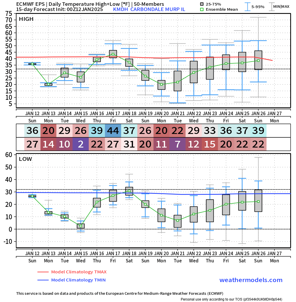
Highlights of chart for analysis, top box is projected highs and bottom box is lows. Red line is normal high and blue line is normal low. Numbers in the middle represent the mean of 50 different variations. The gray boxes (what I focus on) display the solutions representing the 25-75 percentile. Small gray box signifies tight consensus while tall gray boxes provide little confidence in detail BUT when the entire box is above or below a normal line it gives us some sign.
Friday January 17 & Saturday January 18 boxes above gives us a hint that outdoor chores might be easier to accomplish with the slightly warmer conditions but also lead us to know mud could be deeper with more thaw. Single digit low projections appear near the 15th and 21st if we are looking for solid freeze to move heavy equipment. `
So many frontal passages is a sign of no one wave gaining strength. Flurries possible but significant precipitation chances are days away. Couple chances for precipitation appear in the next 2 weeks with the earliest being tied to the 17-18 warmup and will be discussed in another discussion.
Summary: Colder than normal projection is the general rule for the 2nd half of January with some swings highlighted by a warmest expected period around the 17th 18th.