Moisture Flow Will Bring Rain Friday Night
Page created on: 2025-01-13 14:27:57
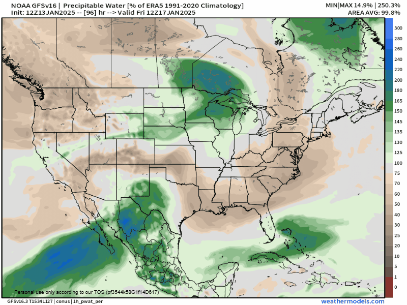
Late week warmup comes with an increased SW flow and to go with that is a push of available moisture from the Pacific Ocean. Chart displays the push across the SW US into the region even picking up some flow from GOM. No cold air trapped in this system so it is a rain maker. The cold front moving in from Northern Plains is displayed as well but rain is expected to be here and leave before the real cold air flows in. There is enough moisture in this system that combined with the big drop in temperatures that flurries are likely Saturday night and Sunday.
Summary: rain showers will move into the region Friday night and linger through the day Saturday. Snow flurries possible Saturday night and Sunday.