Colder A Week From Now
Page created on: 2025-01-14 04:00:30
I have always struggled with what to talk about when the forecast isn't changing. Droning on about the same forecast seems inefficient to me. If you read the last forecast you know what this one says kind of thing. Guidance is showing lots of consistency right now but that doesn't always mean accuracy especially when we are looking 7-14 days out.
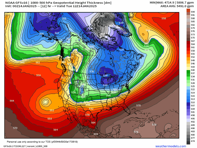
I chose another product to look at today. Technically the distance between 2 pressure heights (500-1000mb), it presents a great graphical view of the density of the atmosphere. Cold dry air is denser than warm humid air so we have another color coded tool to identify air masses. This product also delivers the mythical 540 line. 5400 meters between the pressure levels. In the day of my education this was THE snow line. Today I believe there are much better products to find the line of delineation between precipitation types but it still plays in general outlooks.
Lowest values impact our region around January 21 bringing a forecast of coldest temperatures here at home. Have to believe single digit lows and at least 1 day with afternoon temperatures in teens is reasonable assumption from this chart.
Persistent NW flow during the period relates to dry flow so not a lot of precipitation, of any kind, is expected through the end of January.
Interesting that the 540 line does drop as far south as GOM suggesting if a storm develops next week, we might see snow south of us and not here.
Summary: cold air in place today with warming expected for Thursday - Saturday morning then dropping temperatures to coldest readings around the morning of the 21st. Rain expected with warmup focused Friday night.