Wintry Weather In Charts
Page created on: 2025-01-17 04:46:22
There are multiple winter parameters in guidance during the next 2 weeks but we are in the heart of winter on the calendar and is to be expected. First is the Arctic intrusion early next week. I still can't determine why we are not seeing below zero projections for Monday or Tuesday morning but I still believe it possible. Dew point projections do drop below the threshold and skies should be clearing. We will see.
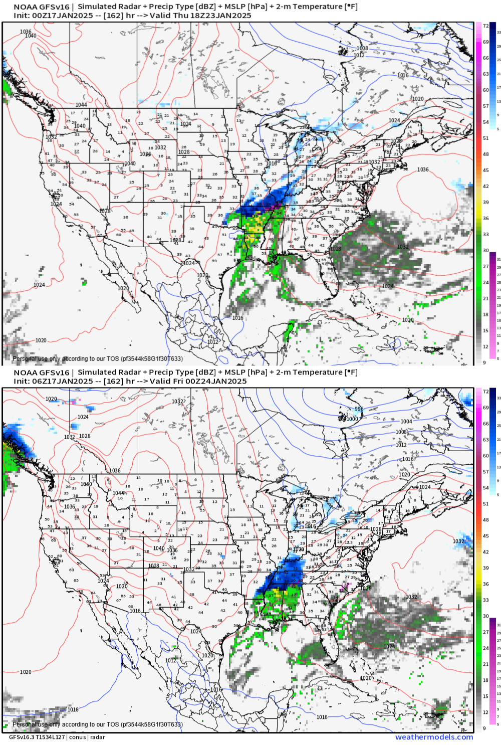
Second event has been in consistent and rather than cherry pick the worst solution I present 2 solutions from successive runs that establish a little consistency and trend. Charts are projections for Thursday presenting chance for snow locally. Potential for significant impact locally.
Third event is winter storm solution timed around the first of February. It already has some consistency in runs so it will be monitored. Looking way out, I see potential for a very wintry February locally.
Summary: rain Friday night before Arctic air arrives and drops temperatures Saturday. Coldest readings Monday and Tuesday with afternoon temperatures in the teens. Chance of accumulating snow Thursday. Chance of accumulating snow around the end of the month.