Week 2 Outlook: Jan26-Feb1
Page created on: 2025-01-19 05:50:07
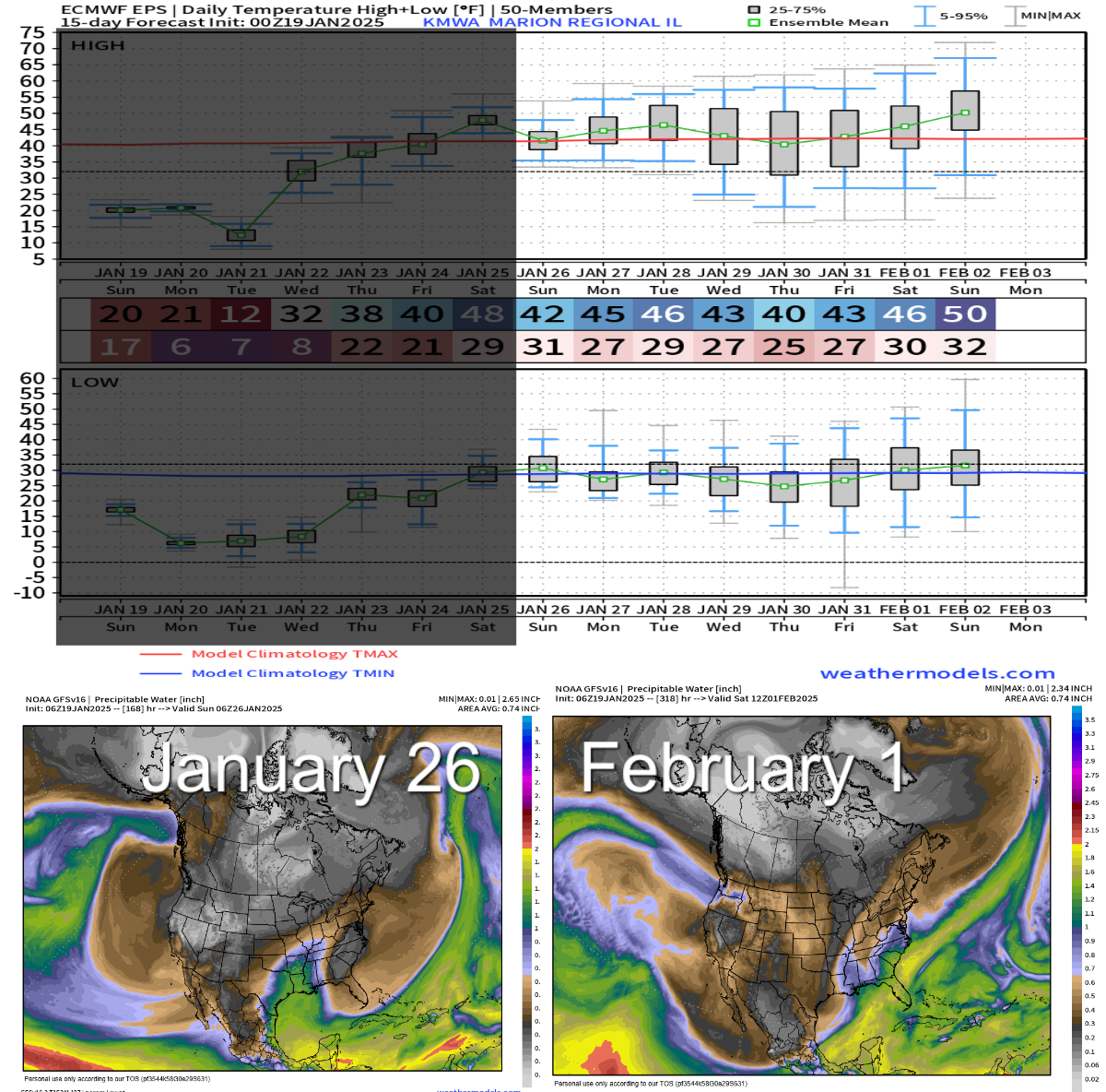
Temperatures back to normal is the big feature of the last week of January. Lows in the 20s and highs near 40 is still chilly but a recover from the Arctic air influenced readings of the week we are in. Available moisture increases with a couple of waves both timed on the weekends of the period. Both events look rain dominated at this point but with normal temperatures and cold fronts in play, switch to winter or winter mix seems a realistic solution. A large winter system has been in the guidance inconsistently around Feb 1 but currently is not. Still far enough away to believe it is possible but current guidance is trending away from it.
Summary: precipitation in outlook around January 26 and January 31. Lows in 20s and highs in low 40s for most of the week Jan26-Feb1. Some potential for wintry weather to be discussed here as it evolves.