Up From Here
Page created on: 2025-01-20 06:11:28
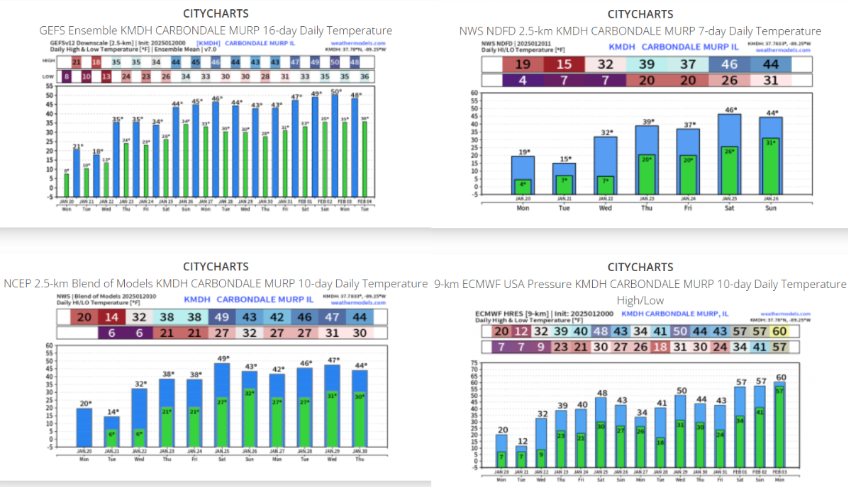
Coldest temperatures from this snap have occurred. No matter what temporal scale we use they all present warming trend. I was surprised we did not see Monday morning readings closer to 0 (I bottomed at 5) bust most data presenting warmer than normal by the weekend. A weak boundary moving past early Tuesday morning will keep Tuesday afternoon colder than Monday. From there it will feel like a rapid warmup all the way to the weekend.
A few snowflakes are possible with mentioned wave and another on Thursday but I don't see much liquid in gauges or snow on the ground.
Summary: Bitter cold will stick around through Tuesday night and winds will increase again for Tuesday and Wednesday. Light snow showers possible Thursday late but no significant accumulation in charts at this point. Warming trend will accelerate late week with projected temperatures in the 40s for the weekend.