Active Pattern 10 Days Out
Page created on: 2025-01-21 13:09:17
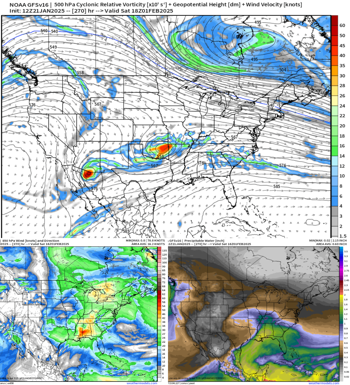
The retreat of Arctic air will likely lead to some weak waves moving past and bringing some chances for light precipitation. Charts have been presenting active pattern around February 1 for some time now and in this data cycle it is the most defined system.
Top map is 500h presenting significant wave to provide lift and shear. Bottom left is low level jet and while it is not extreme it is strong enough to influence and projected from SSE. A flow of that direction almost certainly has to be pushing warm air and originating at GOM it will push moisture as well. Bottom right is available moisture projection and presents the wettest solution of any day in the 16 day outlook.
Summary: middle US storm system is projected to bring rain to our region on or around February 1.