Sunday Winter Mix
Page created on: 2025-01-22 03:22:00
There has been very little consistency on this solution date but fair to expect a mixture of rain and snow in SIL Sunday and will likely be light snow event near OWB Sunday night.
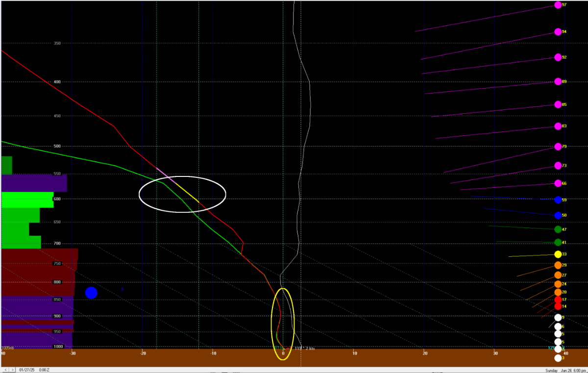
Atmosphere cross section for Sunday afternoon along rt. 13 highlights a couple of reasons I believe if we do see snow, we won't see much.
Snow growth zone (white oval) is not saturated leading to less efficient snow crystal growth and some sublimation possible.
Near surface temperature projected very near freezing line for depth of hundreds of feet. Minor influences will push temperature above freezing in this layer and lead to snowflake melt before reaching surface.
Summary: expect to see liquid in gauge Sunday into Monday morning and will mix with or end as light snow. QPF numbers (amount) are low with liquid total 0.10" and snow numbers in the trace to dust range. High temperatures expected above freezing so impacts will be minimal.