Trending Next Friday Offers Little Insight
Page created on: 2025-01-23 04:23:17
In my efforts to improve my 6-14 day outlooks I have evolved to trending. The idea of picking a wave and watching what guidance does with it for days. Choosing an average does not seem to put an outlook in the right place. My observations are that one of the solutions is pretty spot on even days ahead. The forecasting part of it is trying to find any consistency to build on. Timing changes as we approach verification as well as path.
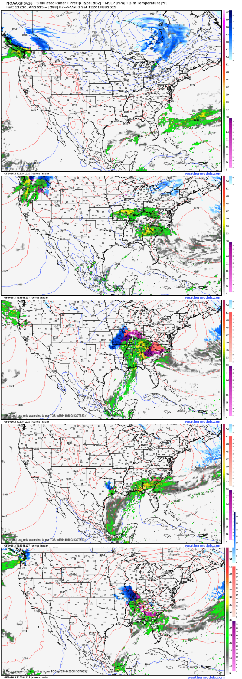
5 panel chart I present is for a wave that has been in guidance since day 14 in one forma or another. We are focused on the time slice of Jan30/Feb1.
5 solutions appearing quite different for the same event. 3 of 5 present precipitation (60%). 2 of 5 present winter mix (40%). 2 of 5 present nothing, a miss (40%).
When using 2 week outlooks to improve efficiency or preparedness we are going to use percentages to improve our long term effectiveness. It does little good to focus on the 40% solution of nothing UNLESS we have a project that has to be done in that time slice. 40% nothing allows us to keep the project scheduled for now until that number changes and leads us to a different reaction. 60% precipitation leads us to expectation of something in the gauge around that time and plans can already be adjusted or at least contingencies established. 40% mix while afternoon temperatures are projected to be well above freezing only matters as a wildcard in case we would see a growing trend with colder temperatures. Really only keeping the possibility alive so not surprised but in reality the 60% precipitation is more important information to work on now.
Summary: rain seems likely around February 1 with a chance it could mix with some ice/snow. Temperatures projected to be warm enough that winter impacts should be low to none.