90 Day Outlook Temperatures
Page created on: 2025-01-24 06:53:53
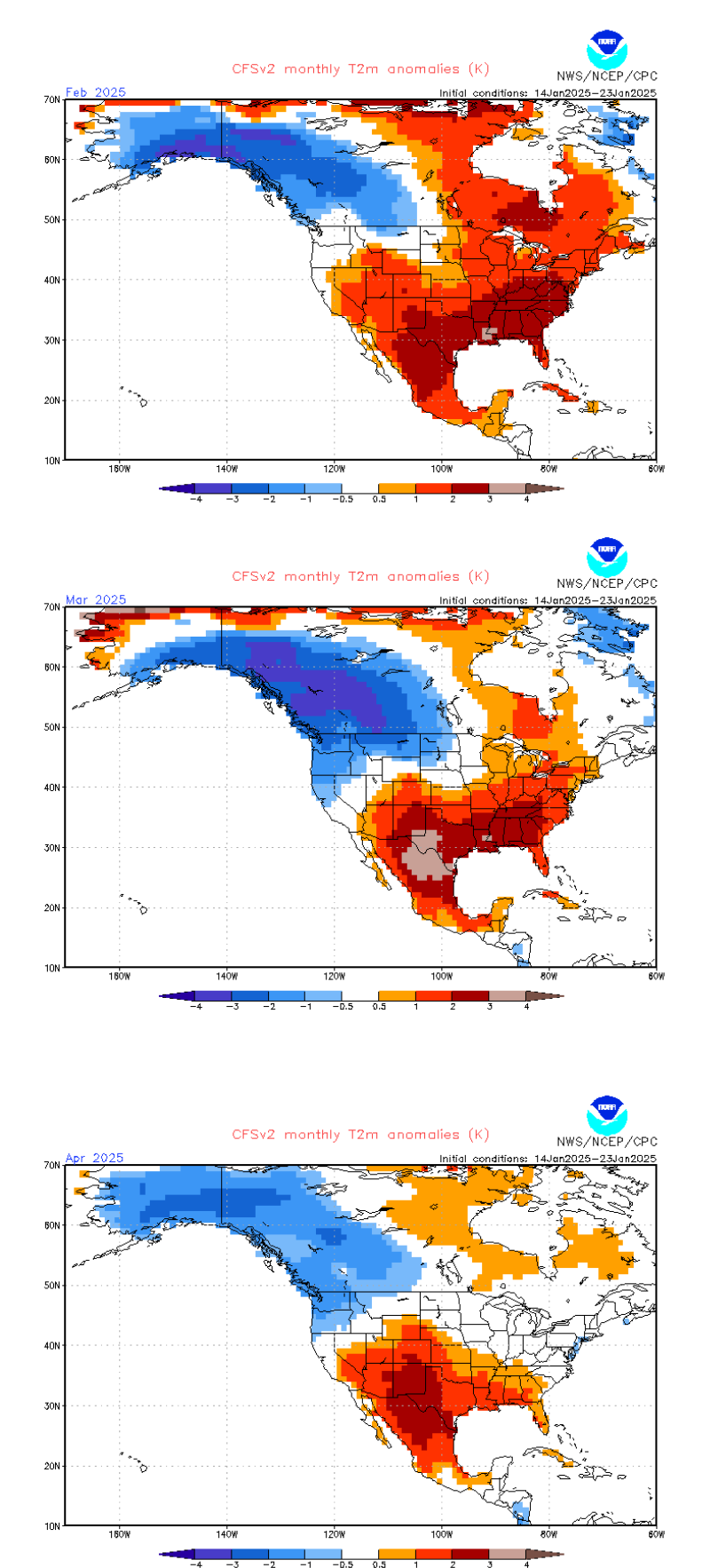
Why look at a 90 day outlook when you can look at 3 30 day outlooks and gain some insight and detail?
February has been wet in every scenario for weeks. With that established we look at temperatures and first glance see presentation of a warmer period. Actually see warmer than normal present for all 3 months of the 90.
Looking deeper the cold source is the Pacific NW. This is a good source to feed general cold fronts for us. This persistent pattern leads me to think an overall mild pattern punctuated by periodic cold fronts. Rain makers. This lines up well with the idea of a wet February. March is presented similar. April has a different feel. The hint of more cold air making it into the Great Lakes and to the Ohio River Valley aligns with hints on the precipitation side that it might start to dry out a bit ending the very wet period anticipated in Feb/Mar. Colder air is drier air.
If I was looking for persistent cold locally I would look for the cold source to be over the Hudson Bay and Great Lakes region.
Summary: 90 day outlook for Feb-Mar-Apr is overall wet with wettest days in Feb and Mar. Overall warmer than normal (relative, it is still winter) with hints that April could be closer to normal temperature wise and precipitation wise.