Winter Mix: Evolution Of A Solution
Page created on: 2025-02-06 05:04:49
Consistency growing in the solution for Monday night into Tuesday of an accumulating snow event.
No consistency in the 2nd wave solution for Wednesday but an interesting evolution.
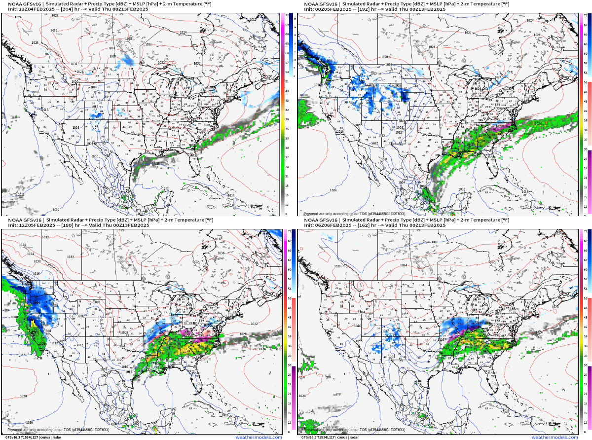
Charts read from left to right top to bottom from oldest to most recent. Over the period of a couple of days the solution has gone from nothing to a freezing rain event. Most recent projected surface temperatures are on or near 32. Moisture edge is on or near I64. If the solution is colder than projected it will be drier leading to less or no precipitation. If the solution is warmer it will remove the winter component and likely be wetter that projected (more moisture farther north). Snow solution on Tuesday seems to grow with each update with more than 1 solution in the 2"-3" range. These near freezing on the line events concern me because I have seen them SURPRISE us with a large solution. Warm temperatures in the days leading to event will help limit early accumulation on hard ground surfaces that will act like heat banks. Accumulations on grassy and elevated surfaces could be significantly deeper by comparison. Less impact for motorists and more snow for admirers. Win-win? Monitoring.
summary: the chance of snow around Feb11-Feb12 has been in my discussions for several days so continuation of accumulating snow expected Tuesday seems logical. 2nd wave event has no consistency but in the name of preparation we should be prepared for some ice as part of a winter mixture Wednesday afternoon.