Huge Temperature Swing In Charts
Page created on: 2025-02-07 04:23:30
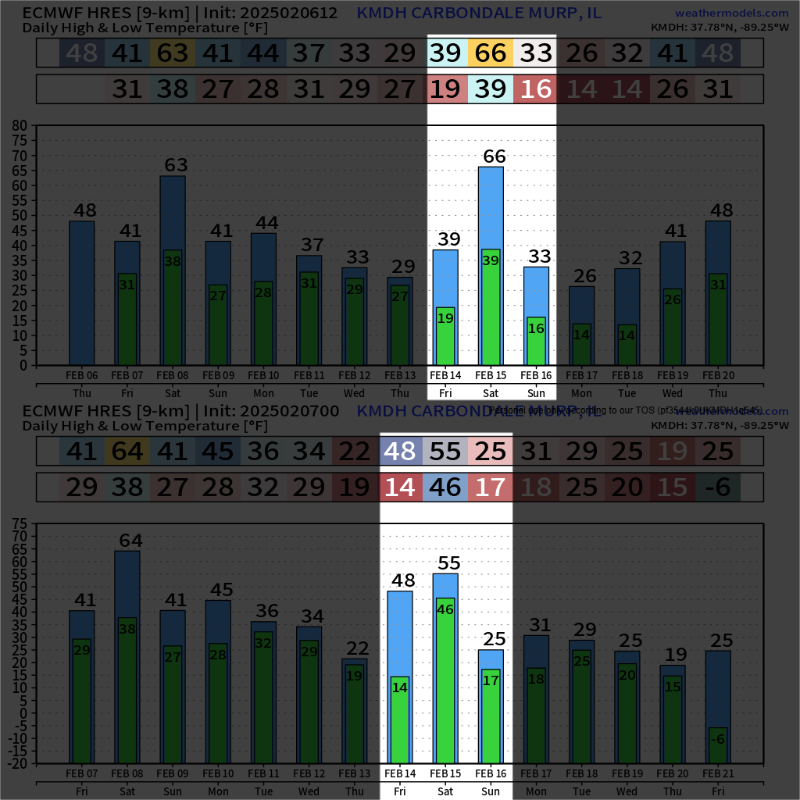
Top chart is from 1 day ago and when I saw it, I might have called BS. The temperature swing projected Feb14-Feb15-Feb16 is low 19 to high 66 to low 16 in about 48 hours. The next update is similar from 14 to 55 to 17. I went searching for any evidence in maps of dynamics that could support not just a large swing up but the return down the following day.
A NW flow will keep cold air moving into the region until a wave moving through flow with its circulation produces a strong low level jet. At the surface it is an approaching cold front and the warm air advection ahead of the front creating the swing. The LLJ is projected to move some moisture so precipitation is expected and current numbers support some snow on the backside. Worth watching.
summary: active weather pattern in the period Feb14 to Feb16 projected to bring a large rise in temperatures leading to a mild high on Saturday after a frigid low Friday followed by frigid temperatures Feb16 to Feb18. Rain and snow possible in the turbulent temperature period.