Friday Storm Risk Analysis
Page created on: 2025-03-12 12:33:38
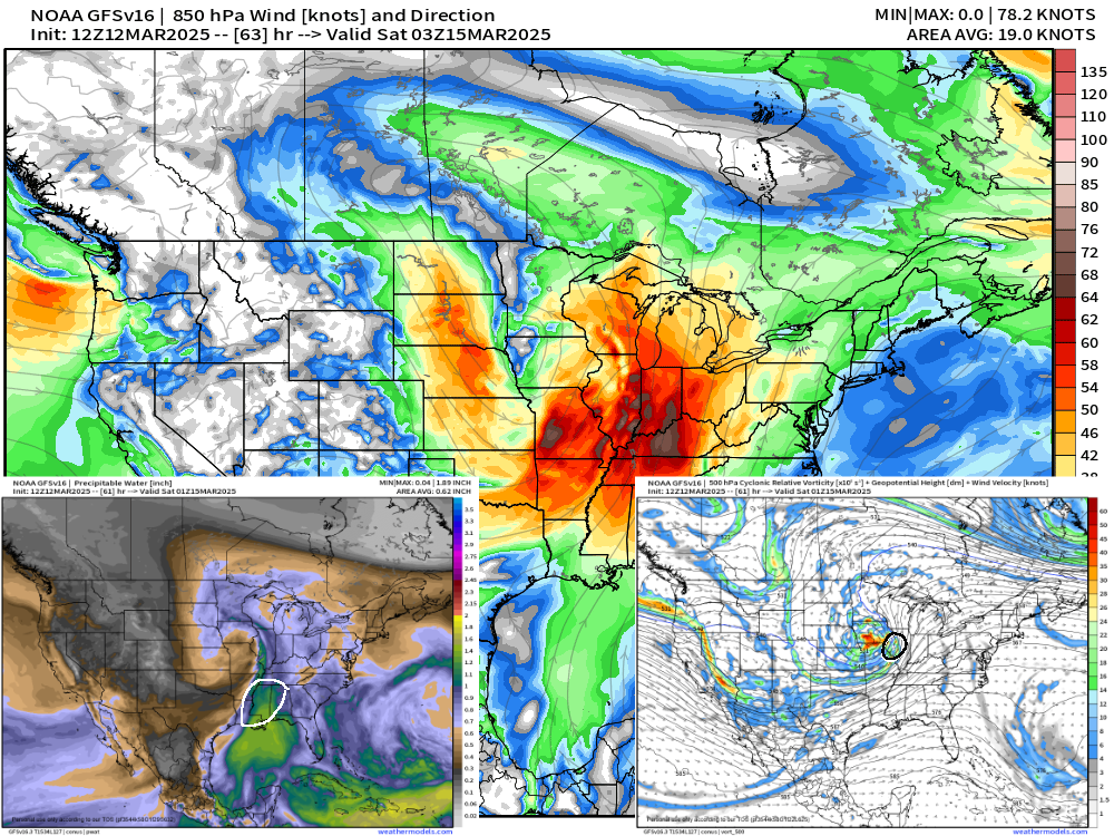
The risk of severe weather Friday evening has been present in solutions for several days. The broad stroke of potential exists but looking for subtle features to highlight areas of concern is just coming into a little focus. I have included 2 additional parameters with the larger map of low level winds. Low level jet and streaks presented as probable inmost of the lower Ohio River valley and timing of maps is around sunset Friday. The intensity of these jets and streaks would be enough to push storms that develop to severe limits especially if focusing on damaging winds gusts. Part of that solution though is, where storms develop. The smaller map showing the orientation of the low pressure center highlights an area to the north where I believe there is more dynamic support for lift and shear. The smaller map showing available moisture highlights the best area for development to our south. Locally (MWA-OWB) appears to me to be a solution of, not everyone sees a storm but storms that develop go severe at some point in the cycle. Wind damage is the biggest risk and is possible without storms but amplified in and near storms. A tornado is possible. Hail seems the least likely of the severe parameter with the Friday evening round of storms. CAPE numbers run small locally for a storm of this size and part of that is due to the main low maturing before its influence arrives here.
summary: a very strong low level jet will bring severe storm chances to our region Friday evening. A tornado is possible and damaging winds are probable.